Can Mateu-Ca l'Arnau
Index
Campaign 2017-2019
Campaign 2016
Campaign 2015
2017-2019 Introduction
During the 2016 and 2018 excavation campaigns, significant developments took place that helped to consolidate our research and field school in Ilduro. In July of 2016, Dr. Sinner started his position as an Assistant Professor in Roman Art and Archaeology in the Department of Greek and Roman Studies at the University of Victoria. Consequently, school participants could now enroll in the course GRS 495: Practicum in Archaeology (3.0 units) that the UVic offers every summer (see details here). In 2018, thanks to the generous support of the Social Sciences and Humanities Research Council, our field school was integrated and contributed to Dr. Sinner’s Insight Grant research project entitled Beyond Contacts: Tracing Identities and Cultural Change in the Roman West, opening a new and very exciting stage for the Ilduro team.
2017-2019: Objectives
During the excavation campaigns conducted between 2017-2019, the project focused on three specific objectives:
- To determine the exact chronology, extension, and functionality of the archaeological levels of reoccupation detected in house 2 of Can Mateu;
- To commence the excavation of rooms 6 and 8 in House 1 in Can Mateu in order to determine the phases of occupation and whether it was reoccupied after its abandonment as happened in house 2;
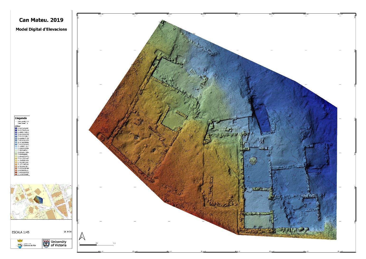
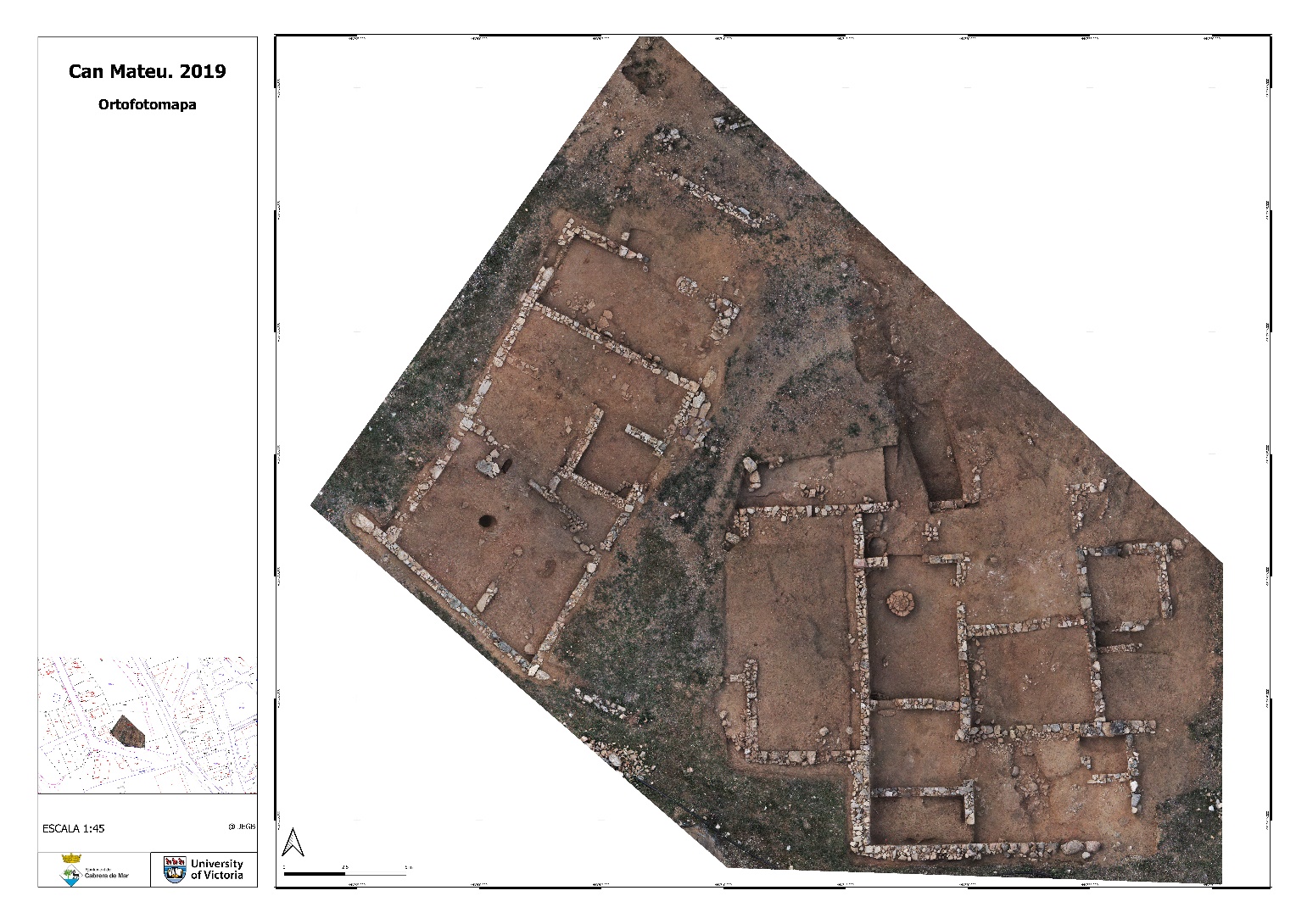
- To conduct a graphic documentation, including detailed photogrammetry, aerial photography, orthophotography, 3D scanning, and Digital elevation models (DEM) of the whole residential sector of Can Mateu (houses 1 and 2).
2017-2019: Results
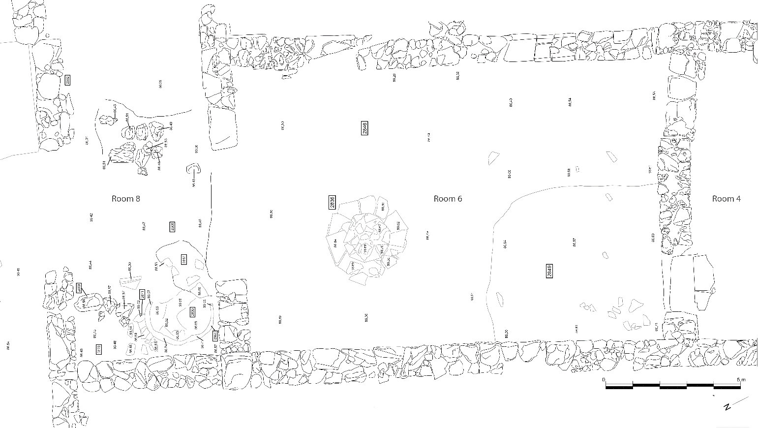
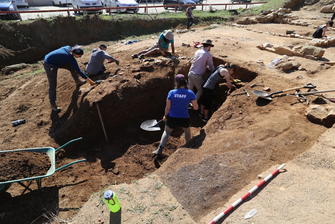
In house 1, our team concentrated on the excavation of rooms 6 and 8. Due to their position in the western side of the house and protection by the retaining wall, their preservation was expected to be quite good.
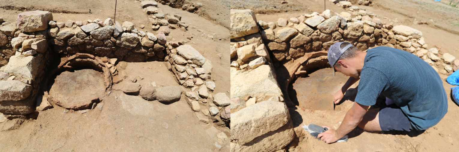
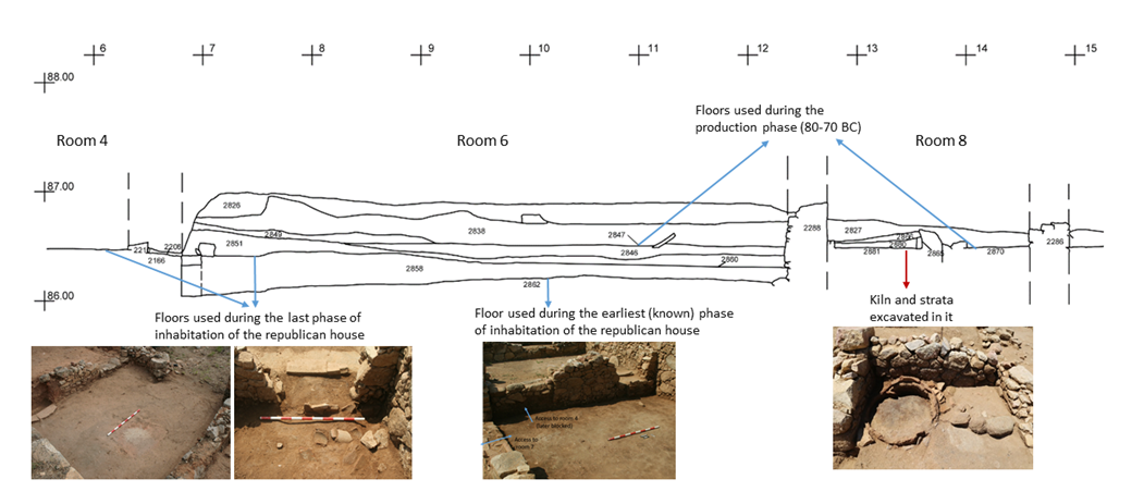
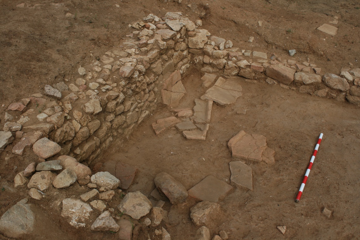
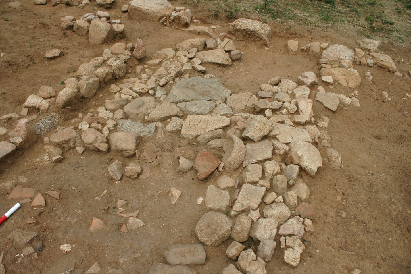
Not long after starting the dig, our team uncovered a very irregular layer made of clay and the remains of poorly preserved mudbrick which was concentrated in the SW sector of the room. This was interpreted to be what remained of the mudbrick superstructure of the wall that separated room 6 from room 4. Once this layer was lifted, a circular structure made of reused (broken) roof tiles emerged. This suggested that SU 2847 was the level that the users of this structure were stepping on to; and UE 2846 was the layer below. In order to build the foundations of the circular structure, a whole cutting through the entire stratigraphy of room 6 was dug in antiquity until finding the remains of SU 2848 (see image below).
The excavation of several layers took place before our team was able to see the full extension of SU 2848 and remove it. At that point, the opening practiced to the wall SU 2166 functioned as a door (marked with roof tile positioned horizontally), connecting rooms 4 and 6. Therefore, at this layer (SU 2060), we discovered a phase in which rooms 2, 3, 4, 5 and 6 of the house appeared to be used (inhabited) simultaneously. Unfortunately, the door towards room 7 was filled by soil during this phase and would not have been useable; hence, it was not possible to determine the relationship between the two rooms. The northern and eastern rooms of the house are not excavated making impossible to know if any of these spaces were used during this phase.
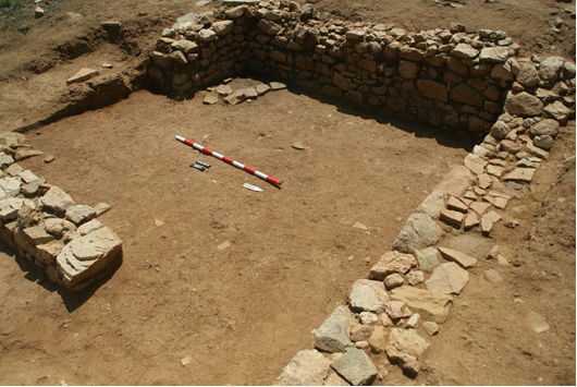
Our team continued the excavation of room 6, this time by digging SU 2858 (under 2860). Aside from unearthing a significant volume of constructive material (imbrex and tegula) it is worth highlighting the discovery of an Iberian coin of the local mint of Ilduro. Below SU 2858, a greyish level of fine sand that spread evenly throughout the room (UE 2862) was found. This level, although it was not excavated, revealed a series of interesting materials on its surface, including the upper part of a pickaxe, two Iberian coins (one from Ilduro) and several nails. It should also be noted that at this point, the door that connected room 6 with room 7 was enabled and therefore, we speculated that we were in a phase in which the two rooms functioned simultaneously. Excavation of SU 2858 also allowed to our team to uncover the existence of the original door connecting rooms 6 and 4 (see image below), pointing out that another phase of habitation should be found under the current floor in room 4.
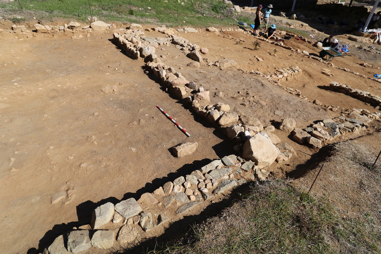
The 2019 excavation campaign focused on excavating room 8 with the goal of better understanding how the different levels of use and abandonment documented in room 6 related the neighboring room. The first level that was excavated was SU 2827. It didn't take long to reveal the vault of a circular furnace which was 80 cm in diameter (UE 2865) and a layer with many fallen roof tiles which partially covered the kiln and the entire western area of the room. The excavation of the interior of the furnace revealed that the stratigraphy was made up of several thin layers. First, we dug the collapsed pieces of the oven clay vault. Below, a very thin strata rich in ashes, interpreted as the remains of the last use of the kiln, was collected for analysis. Finally, the base of the kiln was found to be in a good state of preservation.
At this point, we decided not to continue the excavation of the room. The possibility of consolidating and protecting the kiln had to be assessed before continuing to dig. This process required consultation with Cabrera de Mar Town Hall. On an interpretive scale, it seems very feasible that the oven and the circular structure in room 6 (SU 2836) have functioned contemporaneously around 80-70 BC, once most of house 1 had been abandoned. It cannot be discarded that this reoccupation may extend towards the east (rooms 9 and 12) but only future excavations will determine that.
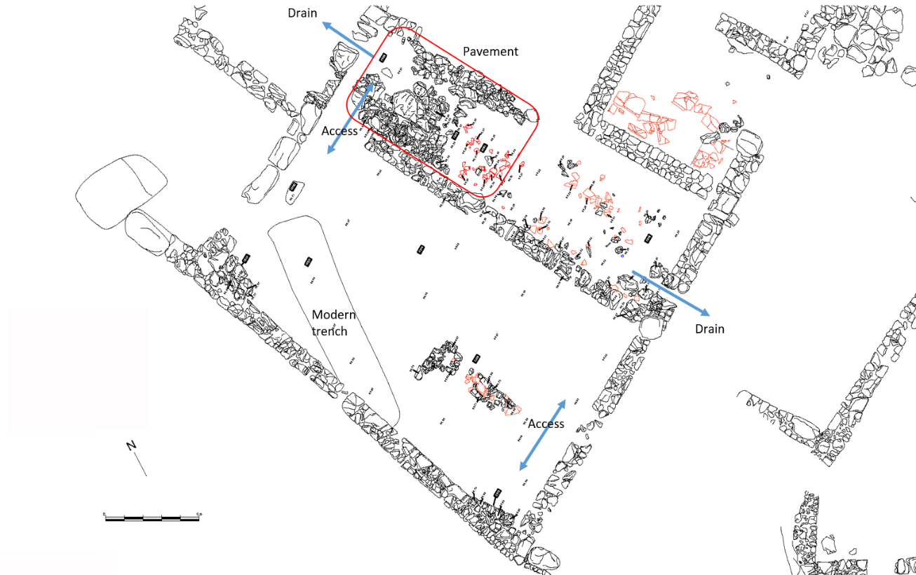
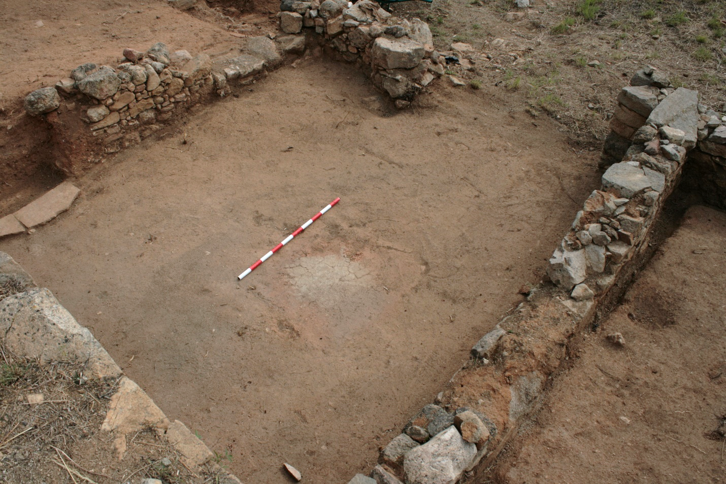
In house 2, the excavation of the archaeological levels located in the rooms previously labelled 4 and 5 has made it possible to understand and reconstruct the stratigraphic sequence that, after the abandonment of the republican house, lead to the creation of a group of structures that functioned at the same time and were interrelated with each other. To outline this sequence of use and occupation, it will be explained in the reverse order from which it was excavated (from older to newer). Once rooms 1-3 were abandoned and no longer maintained, the roof collapsed first followed by the superstructure of the walls (made of clay). That superstructure mixed with other soil deposits washed downhill by the rain, forming an irregular layer that covers (in some cases fully and in others partially) the remains of the house SU 2863.
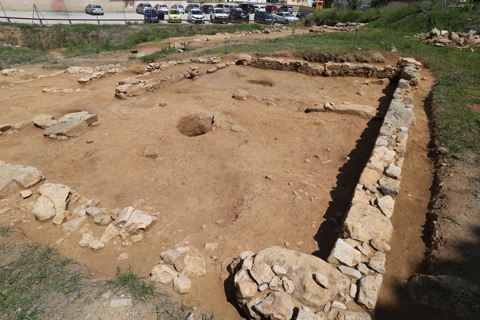
To level this irregular layer and to reoccupy the space, the new inhabitants dumped soil and debris collected nearby creating a thick level that was rich in republican ceramics (discarded materials once the houses were abandoned) and ash which correspond in part with the SU 2824 that our team excavated in 2015. Once this releveling was done, the space was divided into two by building the wall UE 2262.
Later, the pavement UE 2818 in the northern half of room (also unearthed during 2015) was built. The rest of room 4 and room 5, to reach a walkable level similar to that of UE 2818 (stone pavement), was leveled with UE 2835 (room 4) and UE 2839 (room 5), both reclining into wall UE 2262. Once this was done, an additional small room was added in the southwest corner in the larger space (room 5) thanks to the construction of wall UE 2840 (poorly preserved). The coherence of this entire phase at the topographic level and the construction style seems clear and, in addition, the construction of drains in the southwest and northeast corners of the room 4, prove that these spaces were used at this level. SUs 2831 and 2815 covered this phase once the structures had already been abandoned. It is quite possible that this phase extended towards the east, but due to the existing slope and erosion, nothing above SU 2863 has survived.
2017-2019: Conclusions
After several rooms in house 1 and 2 in Can Mateu were excavated, the study of the ceramics confirmed the stratigraphic reading and showed that that around 90/80 BC a large part of the republican housing was no longer functioning as such. In house 1, the finding of a small kiln to make bread and a circular structure probably used to support a rotary mill in two interconnected rooms (6 and 8), lead to the interpretation that these spaces were used as a bread making facility. In house 2, the excavation of the eastern rooms, lead to the discovery of a coherent phase in terms of topography and construction style. The rudimentary drains, absence of roof remains, rough irregular pavement, and simple layout suggested a space to keep livestock. Both facilities functioned around 80-70 BC.
Regarding the republican occupation of the houses, our excavations also confirmed that, at least in house 1, there were a minimum of three different phases of habitation, confirming the complexity of the archaeological sequence in Can Mateu and our expectation of finding levels that date back to 2nd c. BC.
Lastly, it must be highlighted that the goal of elaborating a rich graphic documentation that included aerial photography, 3D models and Digital Elevation Models (DEM) of the entire archaeological area was also achieved with great results.
2017-2019: Acknowledgments
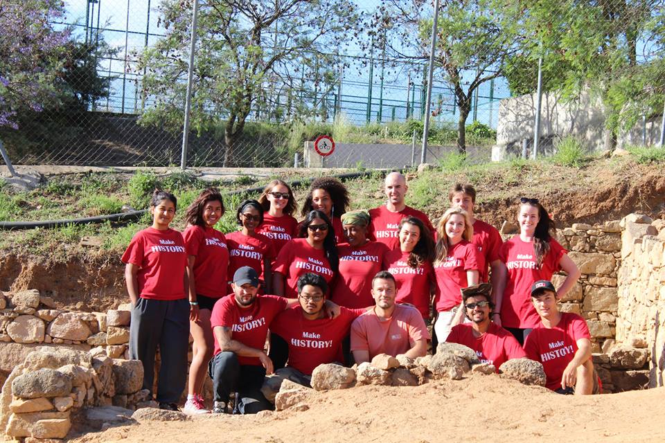
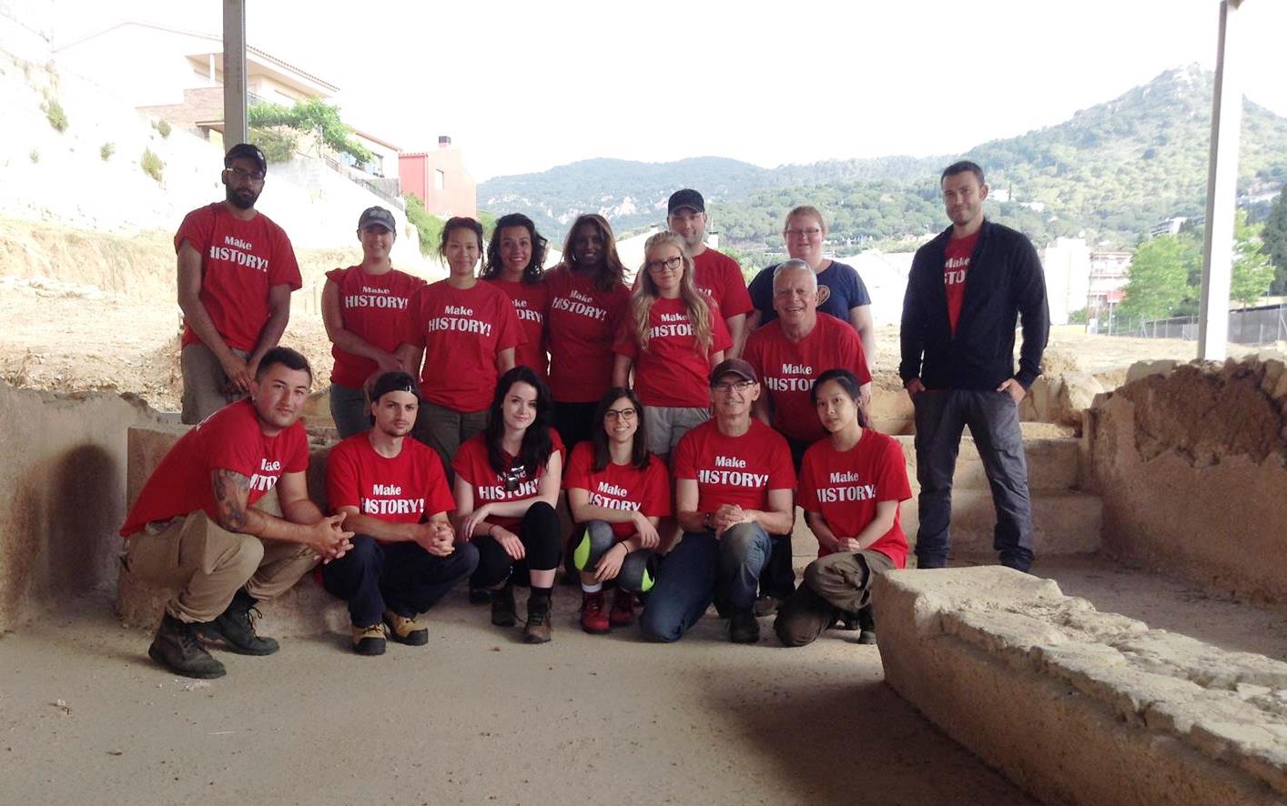
It is important to mention that all the great work and interesting discoveries described above were only possible thanks to the hard work of our field school students and volunteers.
2016: Introduction
In 2016 our project worked once more in collaboration with the History Department in the Faculty of Liberal Arts & Professional Studies and with York International in order to offer a second edition of the experiential education abroad course in classical archaeology (HIST 3136).
2016: Objectives
Our aim for the second campaign of excavations was to start the digging in house number 1 in Can Mateu. The house was only partially excavated during the campaign of 1998 (rooms 1-5) but the remaining rooms of the house (5-13) were never excavated prior to 2016. There were three main goals:
- Uncover and document all the rooms excavated during 1998.
- Uncover the entire plan of the house in order to have an idea of its total surface area, layout, and state of preservation.
- Do an exhaustive photographic and photogrammetric documentation, including a 3D model of the house.
2016: Results
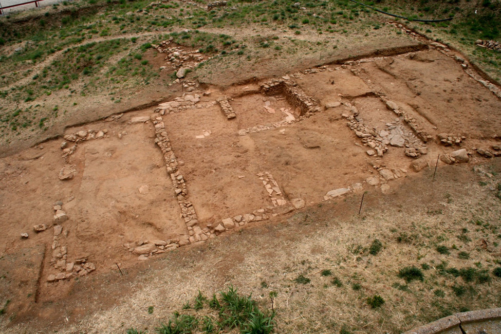
Most of the aforementioned objectives were accomplished. Thanks to our second campaign of excavations, we now know that the total surface of house 1 is over 200 square meters and the remains appear to be very well preserved, specifically the SW corner of the house where the retaining walls were made entirely of stone in order to withstand pressure from the terrain. This makes it the second largest house known in the ancient settlement of Ilduro, only exceeded in size by the impressive household of Can Benet.
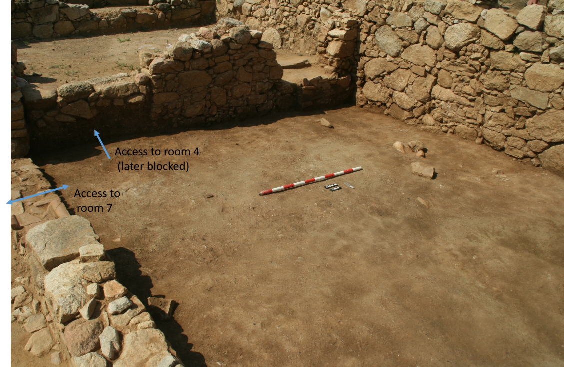
Rooms 1, 2, 3, 4, 5, and the western half of 7, were all part of the 1998 excavation (see plan above). The remaining excavation of the house was only begun during this year’s campaign. It is also crucial to note that this house has a minimum of two phases, and probably more. As can be seen in the plan, the household is composed of at least thirteen rooms (rooms 1 to 13) of all different sizes. So far, the access point to the house is not entirely clear, but due to the fact that the house is attached to another structure—given its western side and a solid retaining wall that closes the construction by its southern side—it only seems feasible that there is an access from the N or E side of the house. Having located an important drain system at the eastern side of the house (between rooms 10 and 11, see images below), it seems possible that the main access to house 2 was through the northern side, facing the baths of Ca l’Arnau. Unlike in house 2, multiple connections between rooms can be detected, such as the access points between Rooms 3 and 4 and 5, or room 4 and rooms 3, 2 and 6 shown here. It is clear that house 1 is not only larger but also has a higher integration and complexity than house 2 in Can Mateu. However, only future archaeological campaigns will reveal how many phases this household has and which rooms where in use in each phase.
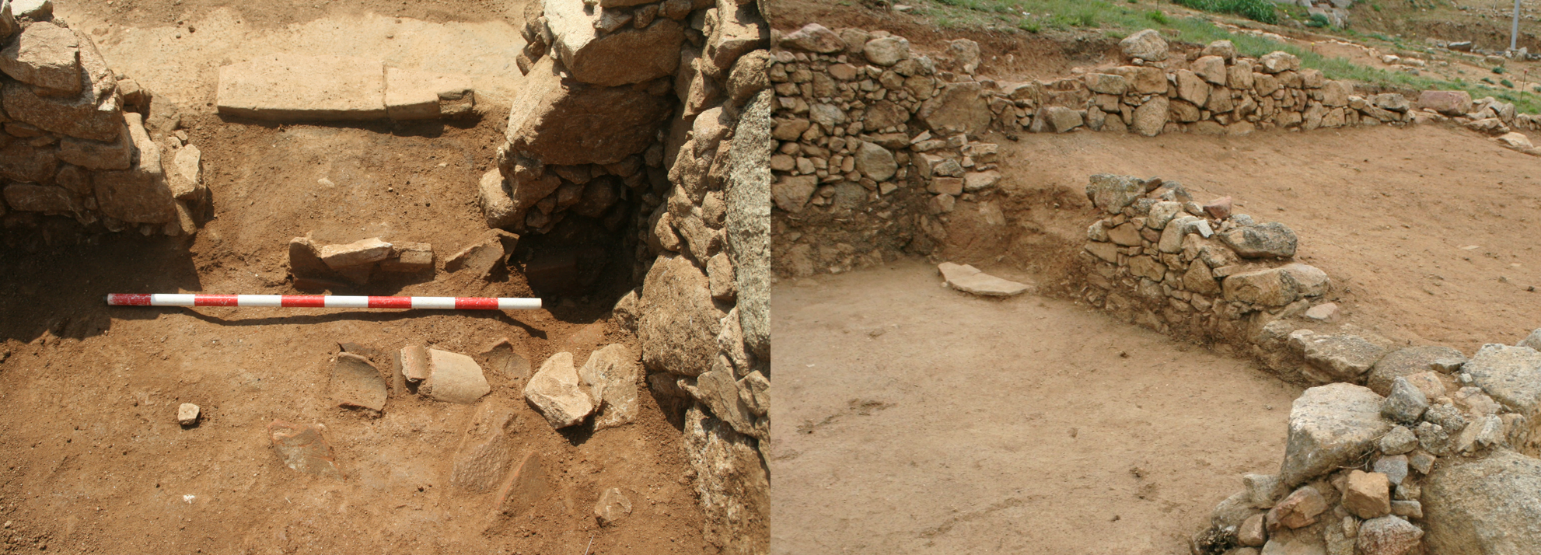
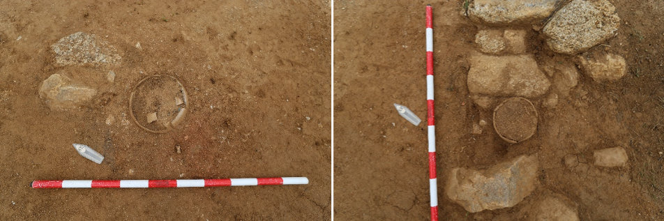
House 1 also includes a complex drainage system in which two amphorae connected to form a pipe were uncovered and recovered in 1998. The drain seems to come out from underneath room 7, making this room especially interesting for future excavations since it seems reasonable to predict the existence of a cistern or complex canalization system within the earliest levels of this room. Its central position and drainage infrastructure are key to understanding the layout structure and water management of the earlier phases of the house.
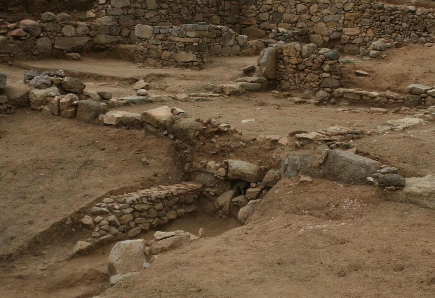
The access point from room 6 to room 7 is also one of the best preserved of the house. The access point utilizes fragments of roof tiles in order to achieve a flat step. The complexity of the doorways and construction techniques in house 1 also shows important differences in style with those documented in house 2. Finally, Room 9 appears to have contained plastered walls. The fact that most of the archaeological surface of the room is covered with white stucco supports this theory. However, only future excavations will confirm or refute this hypothesis.
2015: Introduction
During the summer of 2015, our project worked in collaboration with the History Department in the Faculty of Liberal Arts & Professional Studies and with York International in order to offer a new experiential education course abroad in classical archaeology (HIST 3136).
From this, our field school was created as part of the York University History Department curriculum under the form of a six credit course. The course began with eight three-hour lecture/discussion classes over a span of two weeks at York in which the students examined the historical context of late-Iberian/early-Roman Spain in the second and first centuries BC, and explored significant contemporary archaeological theories, methods and practices. The following four weeks were devoted to the application of this archaeological theory and method to the excavation of House 2 in Can Mateu. Themes studied included: the process of excavation (tools and techniques, plans and sections); soil and stratigraphy (applying the “Harris matrix” and stratigraphic units); recognition and analysis of material finds (pottery, coins, remains of building structures); the interpretation and synthesis of archaeological data; and the value of archaeological evidence for historical analysis of the shifting social, economic, cultural and political conditions at the site in its broader Iberian and Mediterranean contexts.
2015: Objectives
Our goal of the first archaeological campaign was to start the excavation of the so-called house number 2 in Can Mateu. The house was only partially and superficially uncovered during the campaign of 1998 but was never excavated prior to 2015. The main objectives were twofold:
- First was to uncover the entire composite plan of the house. The goal was to have an initial idea of its total surface, layout, state of preservation and, more importantly, to find out if all the visible remains belonged to a single architectonic and chronological phase. Based on the orientation, manufacture, and topography of some of the walls, it seemed that more phases could exist.
- The second objective was to date the abandonment of the structures and to see if it was contemporary to the one documented for the bath complex and the house in Can Benet.
2015: Results
Both objectives were accomplished. Thanks to our first excavation campaign we know now that the architectonic remains extend over a total surface of approximate 100 square meters and seem to be very well preserved, especially in the western part of the site.
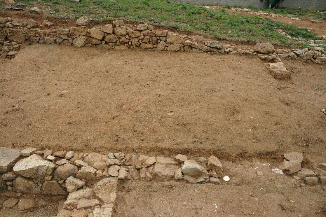
The excavation campaign of 2015 allowed our team to find a group of structures composed of up to seven spaces/rooms that seem to have been abandoned at two different stages. It is important to mention that the known rooms were grouped into two distinct sets, each one with its own nomenclature (A, B and 1-5) based on its accessibility and physical relationships which have been established between the various rooms (see plan below). That being said, the orientation, type of stone, and manufacture of the walls suggests that rooms 4-5 were built during a different stage than rooms A, B, 1-3 and may belong to a different structure.
Rooms 1-3, although partially excavated, are better understood and seem to be rooms belonging to the same late republican household. So far, room 1 was the only room that has been excavated until a level was discovered which clearly belongs to the republican household, as documented by the presence of a hearth and two loom weights. The room was abandoned around 90/80 BC which is around the time when the roof of the structure had collapsed, thus sealing it for over two millennia.
Much less can be determined in room 2, except that the SU 2806, the first SU below the topsoil, seems to reveal a chronology of around 100-75 BC and it will be necessary to narrow it further in subsequent campaigns. Almost nothing can be said about rooms 3 and 5 since they have not been excavated; room 4, on the other hand, has a more complex stratigraphy. What is known now is that a level of preparation composed of a dump of materials (especially pottery) and ashes (SU 2824) and its subsequent leveling has been documented. This level has been dated between 80-70 BC and based on the material culture and its topographic position, it seems to correspond to a reoccupation of the area that took place once the republican house, which belongs to room 1, was already abandoned. On top of this level, a series of stones of different sizes were found to be horizontally placed, forming a rudimentary pavement (SU 2818). The absence of roof tiles on top of this pavement may point out to an unroofed structure.
The second set of rooms (A-B rooms) were not excavated and only delimited and cleaned, so very little can be said. It should be mentioned that these two rooms are connected to each other but do not seem to have any access to rooms 1-3, although the existence of a boarded up door cannot be discarded. For this reason, and although it cannot be ruled out that they are part of the same structure, it has been decided to number them separately as they could belong to a different structure. Within this second set of rooms, it is necessary to emphasize the appearance of up to three possible foundational offerings.
This fact, together with the topographical level at which we worked (lower than in room 1), and the precarious state of the walls, suggests that most of these spaces (the NW corner of room B has a better preserved stratigraphy) were below the levels inhabited in ancient times and, in fact, possibly at construction levels.